Geophysics and Ground Deformation Monitoring Laboratory
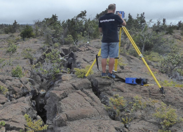
The IPNA-CSIC Geophysics and Ground Deformation Monitoring Laboratory provides scientific-technical services for the collection, analysis and interpretation of geophysical observations using the highest precision geophysical and geodetic instrumentation.
This can be achieved either through the commissioning of geophysical and geodetic data acquisition services (field instrumentation, and generation of raw or pre-processed data), or the provision of advanced processing and consultancy services using the capabilities of our cutting-edge geophysical, geodetic and remote sensing data processing centre.
Type of Analysis
Our methods for ground movement detection are accurate and reliable, drawing on two decades of experience delivering scientifically proven results. Throughout our work we provide precision and accuracy values for our measurements. We use high-precision geophysical and geodetic instrumentation, and can characterise the ground movement spectrum from the seismic frequency range (100 Hz) to slow movements caused by plate tectonics (less than 1 mm/year).
These parameters can be used to quantitatively and qualitatively determine the geotechnical and/or environmental quality of the soils and rocks where to carry out your project and to know: Stability (settlements) of civil engineering structures or private buildings:
- Stability (settlements) of civil engineering structures or private buildings.
- Seismic microzonation of buildings or singular infrastructures.
- Risk assessment for volcanic and/or seismic hazards.
- Ground impact due to extraction or injection of fluids (groundwater, oil/gas, geothermal, etc.).
- Ground impact due to excavation (tunnels, mining activity, etc.).
- Environmental impacts from fires and changes in soil moisture.
Measurement parameters
Parameters to be measured will depend on the type of analysis requested, among which we highlight:
- Characterisation of dynamic ground movement at seismic frequencies (broadband from 100 Hz to 120 seconds).
- Static ground movement characterisation ( isolated or over large areas)
- Horizontal and vertical point positioning with 1 cm accuracy (GNSS)
- Large area ground deformation monitoring using radar interferometry with historical catalogues from 1992 to present.
- Detection of terrain changes due to fires or floods (perimeter mapping).
Equipment
Equipment available:
- Broadband seismic sensors, 100 Hz to 120 seconds.
- MultiGNSS antennas and receivers.
- High resolution inclinometers, up to 25 nanoradians.
- Data processing server with CPU and GPU computing.
- Data storage server up to 160 TB.

How can I request a service?
Contact us!
info [at] ipna.csic.es (Contact us!)